
Utara’DAILY: A 6.2-Magnitude Earthquake Struck Peru, Prompting BMKG to Declare No Tsunami Potential in Indonesia
A 6.2-magnitude earthquake struck Peru, sending shockwaves through parts of South America and immediately drawing attention from seismic monitoring agencies around the world. However, despite the quake’s strength and its location along a highly active tectonic zone, Indonesia’s Meteorology, Climatology, and Geophysics Agency (BMKG) swiftly confirmed that the event posed no tsunami threat to Indonesia.
Therefore, while global seismic activity once again reminded the world of Earth’s volatility, Indonesian authorities moved quickly to reassure the public. Moreover, the incident highlighted the importance of international monitoring systems, rapid data sharing, and clear public communication in disaster risk management.
This Utara’DAILY report analyzes the Peru earthquake, explains why it did not trigger tsunami concerns for Indonesia, and explores broader implications for global seismic preparedness.
Overview of the Peru Earthquake
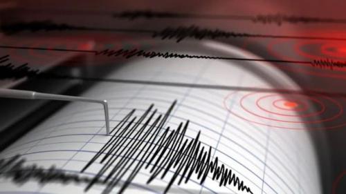
The earthquake struck offshore Peru with a magnitude of 6.2, according to international seismic agencies. Tremors were felt in several coastal and inland regions, causing momentary panic among residents.
Although local authorities assessed potential damage, early reports indicated limited structural impact. Nevertheless, the quake underscored Peru’s vulnerability to seismic events due to its location along the Pacific Ring of Fire.
Meanwhile, monitoring agencies across the Pacific basin immediately began evaluating potential tsunami risks.
Peru’s Position on the Pacific Ring of Fire
Peru sits along one of the most seismically active regions on Earth. The Pacific Ring of Fire stretches across multiple continents and accounts for the majority of global earthquakes and volcanic eruptions.
Therefore, earthquakes in Peru occur relatively frequently. However, not every quake generates tsunami potential, especially those with specific depths and fault mechanisms.
Understanding these factors becomes essential for accurate tsunami assessments.
Immediate Global Seismic Monitoring Response
Within minutes of the earthquake, global seismic networks recorded and analyzed the event. Data flowed rapidly between international agencies, including those in Asia-Pacific regions.
Consequently, Indonesia’s BMKG received real-time information regarding the quake’s magnitude, depth, and epicenter.
This rapid data exchange enabled BMKG to assess risks accurately and issue timely statements.
BMKG’s Official Statement Explained
BMKG confirmed that the 6.2-magnitude earthquake in Peru did not pose tsunami potential for Indonesia. Officials emphasized that several technical factors influenced this conclusion.
First, the quake’s energy and depth did not meet tsunami-generating thresholds. Second, the distance between Peru and Indonesia significantly reduced any oceanic impact.
Therefore, Indonesian coastal areas remained safe.
Why Not All Earthquakes Trigger Tsunamis
Many people associate strong earthquakes with tsunamis. However, tsunamis require specific conditions.
An earthquake must:
- Occur underwater
- Displace a large volume of water
- Involve vertical seabed movement
In this case, the Peru earthquake did not cause significant vertical displacement.
Therefore, tsunami formation did not occur.
The Role of Earthquake Depth
Depth plays a crucial role in tsunami potential. Shallow earthquakes tend to displace seabeds more effectively.
However, deeper earthquakes release energy differently. As a result, they rarely generate tsunamis.
BMKG confirmed that the Peru earthquake’s depth reduced its tsunami risk.
Distance and Energy Dissipation Across the Pacific
Even when tsunamis form, distance matters. Energy dissipates as waves travel across oceans.
Given the vast distance between South America and Southeast Asia, any minor ocean disturbances would weaken significantly before reaching Indonesia.
Therefore, Indonesian waters remained unaffected.
Indonesia’s Tsunami Monitoring Infrastructure
Indonesia operates one of the most comprehensive tsunami monitoring systems in the region. BMKG integrates seismic sensors, ocean buoys, tide gauges, and satellite data.
Moreover, Indonesia collaborates with international agencies to enhance early warning capabilities.
Therefore, authorities can issue accurate alerts quickly.
Public Reaction in Indonesia
Following the news of the earthquake, some Indonesians expressed concern on social media. Memories of past tsunamis heightened sensitivity to seismic events.
However, BMKG’s clear communication helped calm public anxiety.
Consequently, panic did not spread widely.
The Importance of Transparent Communication
Clear messaging plays a vital role in disaster management. When authorities communicate early and transparently, public trust increases.
BMKG’s immediate clarification prevented misinformation from spreading.
Therefore, communication proved as important as technical monitoring.
Comparing This Event With Past Tsunamis
History shows that not all large earthquakes lead to tsunamis. For example, several strong quakes worldwide caused minimal ocean impact.
In contrast, some moderate earthquakes triggered devastating tsunamis due to shallow depth and fault orientation.
Therefore, magnitude alone does not determine risk.
Lessons From the 2004 Indian Ocean Tsunami
Indonesia’s sensitivity to tsunami warnings remains deeply influenced by the 2004 Indian Ocean tsunami.
That disaster reshaped disaster preparedness policies and public awareness.
Consequently, authorities now prioritize rapid assessment and communication.
Peru’s Disaster Preparedness Context
Peru also invests heavily in earthquake preparedness. Building codes, evacuation drills, and public education reduce risk.
Nevertheless, seismic threats remain constant.
Therefore, continuous preparedness remains essential.
Global Cooperation in Seismic Monitoring
International cooperation enables faster and more accurate assessments. Agencies share seismic data instantly across borders.
BMKG benefits significantly from this collaboration.
Therefore, global partnerships strengthen national resilience.
Climate Change and Seismic Activity: Clearing Misconceptions
Some misinformation links climate change directly to earthquakes. However, scientists emphasize that tectonic forces drive seismic activity.
Nevertheless, climate change affects disaster vulnerability by increasing coastal risks.
Therefore, preparedness must address multiple hazards.
Tsunami Warning Systems in the Pacific
The Pacific Tsunami Warning System monitors seismic activity across the basin.
When earthquakes occur, systems calculate potential wave propagation.
Therefore, countries receive early alerts even when risks remain low.
Why Indonesia Monitors Distant Earthquakes
Indonesia monitors global earthquakes because distant events can still affect the region.
Historical examples demonstrate how trans-oceanic tsunamis travel vast distances.
Therefore, no significant quake goes unmonitored.
Public Education and Risk Literacy
Disaster literacy empowers communities. Understanding tsunami mechanisms reduces panic and misinformation.
BMKG continues promoting public education through schools, media, and digital platforms.
Therefore, informed citizens respond calmly.
The Role of Media in Disaster Reporting
Media coverage influences public perception. Accurate reporting reinforces official messages.
However, sensational headlines can increase fear.
Therefore, responsible journalism remains essential.
Indonesia’s Ongoing Disaster Preparedness Efforts
Indonesia continues improving disaster preparedness through:
- Early warning systems
- Evacuation planning
- Community training
- Infrastructure resilience
Therefore, preparedness evolves continuously.
Seismic Activity Trends in 2025
Global seismic activity remains within historical norms. However, increased monitoring improves detection.
Therefore, more reported earthquakes do not necessarily mean more earthquakes occur.
Technology simply enhances visibility.
How BMKG Evaluates Tsunami Risk
BMKG evaluates tsunami risk through:
- Magnitude analysis
- Depth assessment
- Fault mechanism evaluation
- Ocean modeling
This multi-layered approach ensures accuracy.
Avoiding Public Complacency
While reassurance matters, authorities also warn against complacency.
Preparedness must remain constant despite low risk.
Therefore, balanced messaging remains key.
Emergency Preparedness Beyond Tsunamis
Earthquakes cause hazards beyond tsunamis, including landslides and infrastructure damage.
Therefore, preparedness must remain holistic.
Indonesia continues strengthening earthquake resilience inland as well.
Technology and Real-Time Monitoring
Advances in AI and satellite monitoring enhance early warning accuracy.
Therefore, future systems may provide even faster alerts.
Indonesia invests in these technologies steadily.
The Psychological Impact of Earthquake News
Frequent disaster news can cause anxiety. Authorities must consider mental health impacts.
Clear reassurance helps reduce stress.
Therefore, communication strategies matter deeply.
What This Event Means for Indonesia
The Peru earthquake served as a reminder, not a threat.
BMKG’s confirmation demonstrated preparedness and capability.
Therefore, public confidence in monitoring systems increased.
Global Awareness and Shared Responsibility
Natural disasters transcend borders. Shared monitoring benefits all nations.
Therefore, global solidarity strengthens disaster resilience.
Conclusion: Preparedness Through Knowledge and Communication
In conclusion, the 6.2-magnitude earthquake that struck Peru drew international attention but posed no tsunami threat to Indonesia, as confirmed by BMKG.
Rapid data analysis, global cooperation, and transparent communication prevented panic and misinformation. Moreover, the event reinforced the importance of understanding seismic science rather than reacting solely to magnitude figures.
As seismic activity continues worldwide, Indonesia’s preparedness, supported by strong institutions like BMKG, remains a crucial safeguard for public safety. Utara’DAILY will continue monitoring global seismic events and their implications for regional security and resilience.